General information
Client: Government of the Federal State of Northrhine Westphalia and Water Association WVER
Location: North Rhine Westphalia, Germany
Project duration: 2015 - 2019
Key characteristics: EU Flood Risk Management Directive, flood hazard and risk maps, hydraulic simulations
Project description
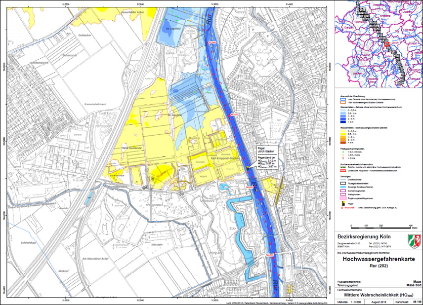
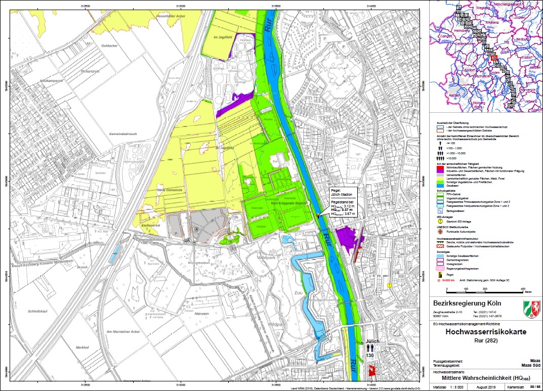
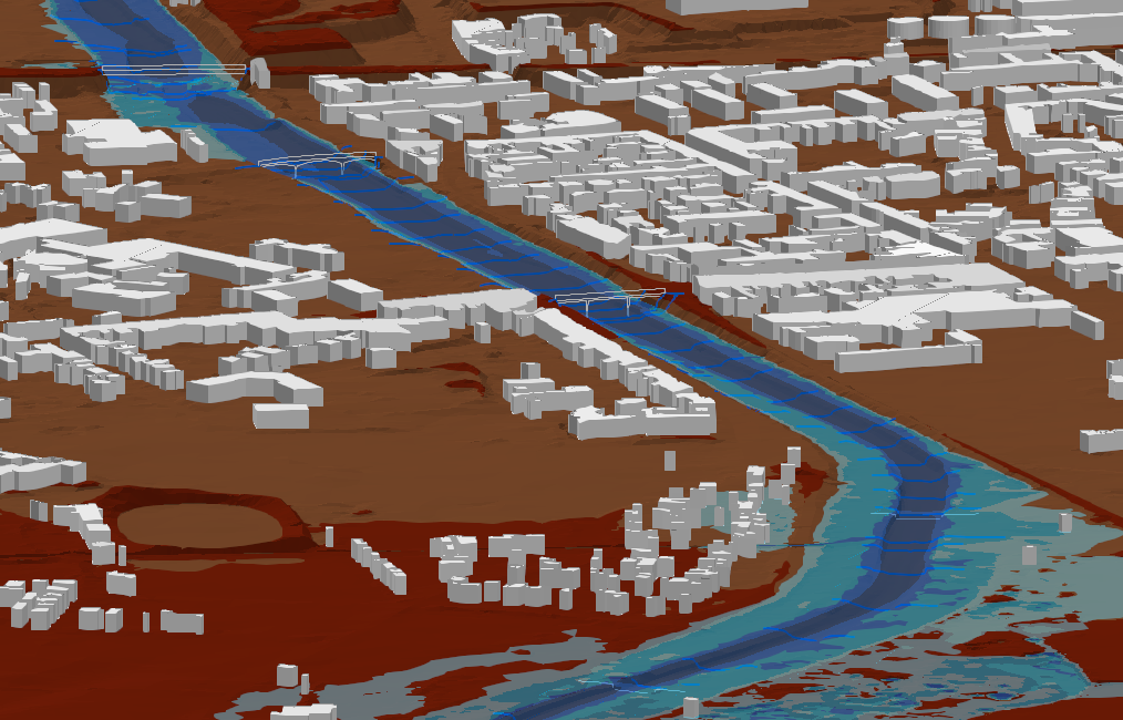
The assessment and management of flood risks is stipulated by the EU Flood Risk Management Directive. This directive requires Member States to assess if water courses are at risk from flooding, to map the flood extent and assets and population at risk in these areas and to take adequate and coordinated measures to reduce this flood risk. SYDRO was commissioned to implement these requirements for the River Rur and to assess the flood extent and generate flood risk maps in compliance with the directive.
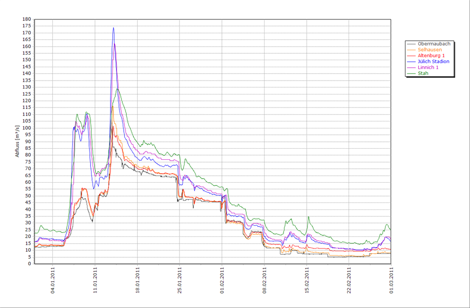
Flow of the River Rur is strongly affected by reservoir operation. This is why the hydraulic assessment was complemented by a risk analysis incorporating reservoir operation.
The new flood hazard and risk maps were published by the ministry on the website flussgebiete.nrw.de.
Services
- Comprehensive data analysis of the laserscan DEM model with ground truthing
- Onsite analysis
- Planning and supervision of the topographical survey of the river bed and the floodplains
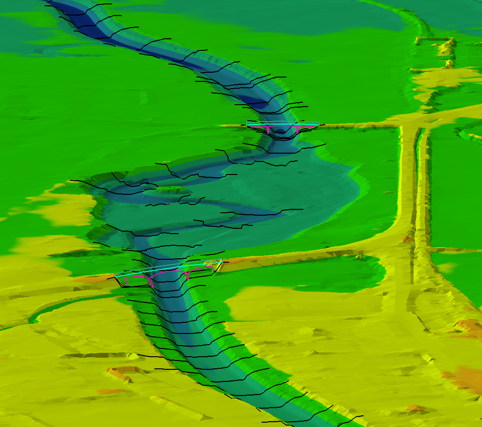
- Setup of an appropriate digital elevation model for 2D hydraulic modelling
- Risk analysis of the operation of the reservoirs associating releases with probabilities
- 2D hydraulic modelling
- Generation of flood hazard and risk maps according to the EU Flood Risk Management Directive
- Presentation on results, consultation and negotiation with the state authority and the water board
Skills
- 2D hydraulic modeling
- Risk analysis
- Mapping