General information
Client: Municipality Bad Homburg
Location: Bad Homburg (north-east of Frankfurt); Germany
Project duration: 12/2012 - 07/2013
Key characteristics: Emergency preparedness, City Bad Homburg, flood action maps, flood retention
Project description
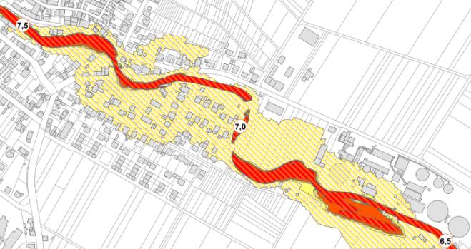
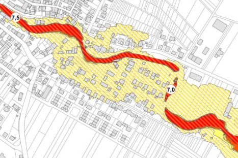
Flood events struck areas of the city Bad Homburg and caused considerable damages in the past. The municipality in conjunction with the task forces of Bad Homburg requested flood action maps which enable them to integrate disaster risk reduction in urban planning processes and launch countermeasures. Procedures to enhance lead time by means of monitoring, accessibility to critical areas, flow velocities and evacuation routes were of particular interest and were developed. Various areas for developing local flood retention were evaluated and integrated in urban development zoning plans.
Services
- Consultation with city government and task forces
- Field missions
- 2D hydraulic modelling
- Identification and design of static and temporary flood protection measures
- Identification of monitoring procedures to increase lead time
- Development of flood action maps
- Identification and evaluation of possible flood retention areas
Skills
- 2D hydraulic modeling
- Flood risk management
- Mapping
- Monitoring plans